Project Overview
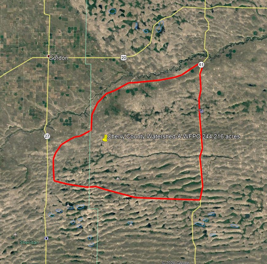
Cherry County Watershed Plan-A area covers 244,216 acres. The watershed landscape is unique to the state of Nebraska containing sandhills, meadows and forested areas. Most of the land use in the Plan area is grass/pasture (90%), certified irrigated acres (2%), and forest/water/wetlands (8%). The largest community near the Plan area is Valentine, Nebraska, population 2,741. Valentine is the center of agriculture and a regional tourist destination due to its rural area, the Niobrara National Scenic River, fishing, hunting, wildlife, and scenic views.
Purpose and Need
The project purpose is watershed protection, water management, water quality management, and public fish/wildlife habitat. Project goal is to establish a recommended plan through an assessment of alternatives supported by public engagement and sponsor participation following the NEPA process. The project is needed to address stream degradation, bank erosion, inundated hay meadows, calving areas, and infrastructure associated with excessive flows. The excess water is degrading hay meadow composition, roads (bus routes, mail routes) and property. The planning process will further define purpose and need.
Proposed Action
This planning initiative will result in a Plan-EA that will identify and prioritize site specific structural and non-structural actions to accomplish project goals. It will assist the Sponsor in identifying locations for stream restoration, irrigation water management, and watershed BMPs.